
The alternative public transit and walking suggestions will appear on the bottom of the screen in a card that says, “Also consider” which will include a preview of the alternative actions recommended. The card will also let the user know if any of these alternatives are faster than driving. The goal is to find alternatives that use lower amounts of carbon. The feature will be available in 15 cities around the world over the next few weeks including Amsterdam, Barcelona, London, Montreal, Paris, Rome, and Sydney.
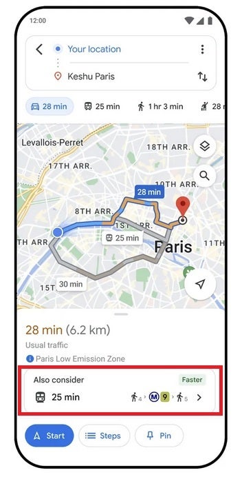
Red box shows alternative public transit suggestions on Google Maps
Google Maps is also getting a feature that will, in Search, help users find more information about long distance train and bus routes. For example, if you search for “Boston to Philadelphia train,” schedules and ticket prices will appear on the results page along with links that you can tap on to book your trip. This feature can be accessed for trains in 38 countries and for bus routes in 15 countries.
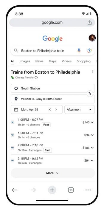
Looking up trains and buses on Google Search will show you schedules and pricin
Google is trying to give people the information they need to choose the low-carbon alternative when traveling.
Source link